September 9 – 20
Satiated after our Machaca burrito, we got cleaned up and hopped in the car to start our driving tour of the area. We found the route at Sedona.Net and would make good use of it over the course of a couple of days. Our first stop would be back at the trailhead for the Bell Rock Pathway and its views of Bell Rock and Cathedral Butte.
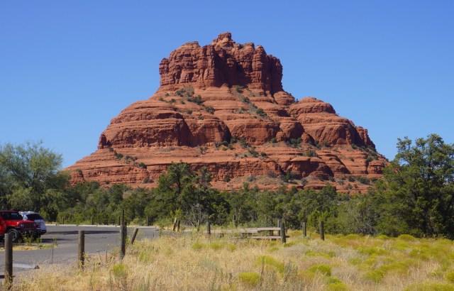
Bell Rock
The pathway is a 3.6-mile trail where you will catch views Bell Rock, Courthouse Butte, and other landmarks. As most of the pathway has a wide, hard surface, it can also be accessed by bicycle, something we will need to do the next time we pass through the area.
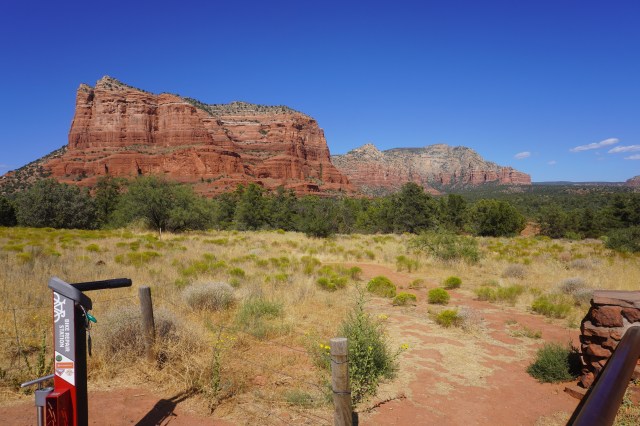
View from the Bell Rock Trailhead
Our next stop was 3 miles north when we turned off on Back O’ Beyond Road to get to the trailhead for Cathedral Rock. On another day we might have attempted the 1.3 mile hike up to its summit, but then again reading a description makes one think it might be a bit more strenuous than I can tackle anymore, a recent MRI and honest appraisal of my back’s condition beginning to rule out hiking as an exercise option for me.
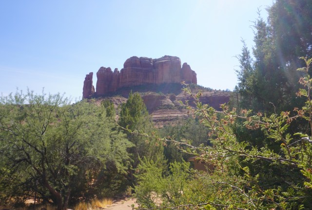
Cathedral Rock
Back on Highway 179, we drove north a half mile to Chapel Road, and up a hill to the famous Chapel of the Holy Cross. The chapel was commissioned by local rancher and sculptor Marguerite Brunswig Staude, who had been inspired in 1932 by the newly constructed Empire State Building.
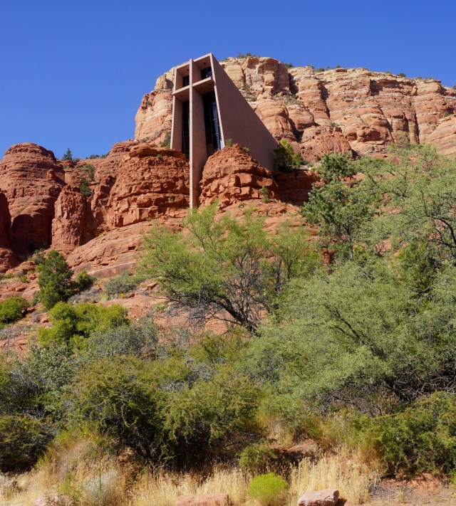
Chapel of the Holy Cross
After an attempt to do so in Budapest, Hungary (with the help of Lloyd Wright, son of architect Frank Lloyd Wright) was abandoned due to the outbreak of World War II, she decided to build the church closer to home here in Sedona.
View of Surrounding Houses
Richard Hein was chosen as project architect, and the design is by architect August K. Strotz, both from the firm of Anshen & Allen. The chapel was built in 18 months at a cost of $300,000 and was completed in 1956. The American Institute of Architects gave the Chapel its Award of Honor in 1957.
From the Fountain
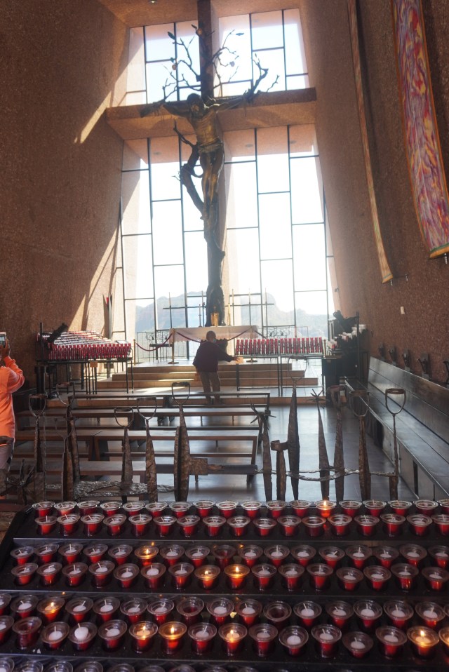
The main feature of the chapel is a 90 ft tall iron cross on the southwestern wall, which serves both aesthetic and structural purposes. Marguerite was inspired by the powerful image of the steel framework in the Empire State building and her idea for the cross was carried out by sculptor Keith Monroe, from San Francisco. The cross holds both the altar and Corpus on the interior.
Interior with the Cross
It is a truly remarkable building incorporated into a natural surrounding and worship there must be inspiring. We parked below and walked up to the site and spent some time admiring the interior and the amazing views it presents of the red walls that frame it.

J and J at Holy Cross
We left the chapel and continued north on the highway into Sedona, a route we’d repeat a number of times during out stay. Just before the round-about splitting the 179 and 89A, we pulled into the parking lot at the Tlaquepaque Arts & Shopping Village so Joanna could browse the shops, having heard that it might be a good resource for interesting merchandise. I threw my lot in with the Oak Creek Brewing Co., located on the far end of the parking lot and upstairs.

Tlaquepaque Arts and Shopping
For the very first time, and not comfortably I might add, I sat at a bar indoors while I drank one beer. I maintained a safe distance from the other two customers at the time and although the beer was quite good and thirst quenching, in the end the pall of Covid hung over the experience and needless to say, I didn’t dawdle, meeting Joanna not long afterwards in the parking lot.
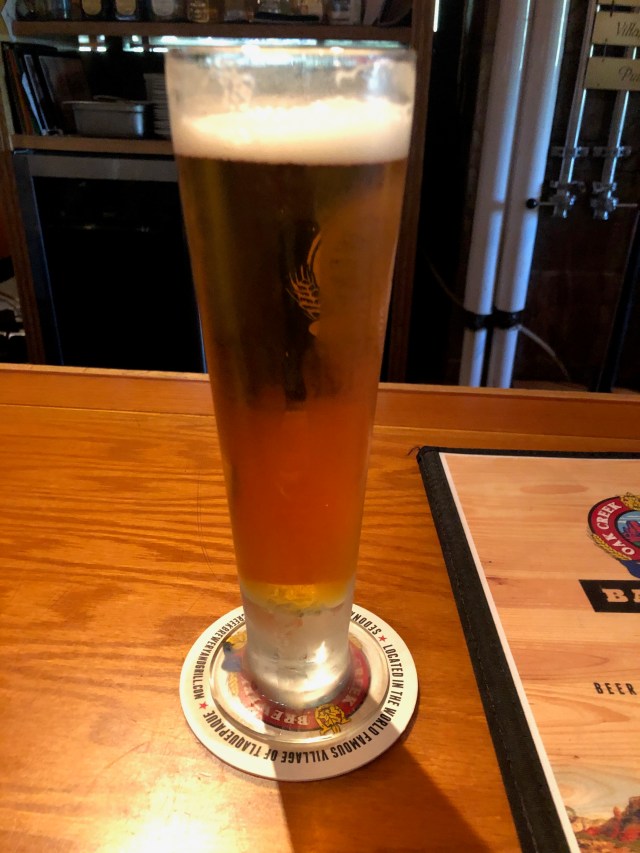
That Cold Beer
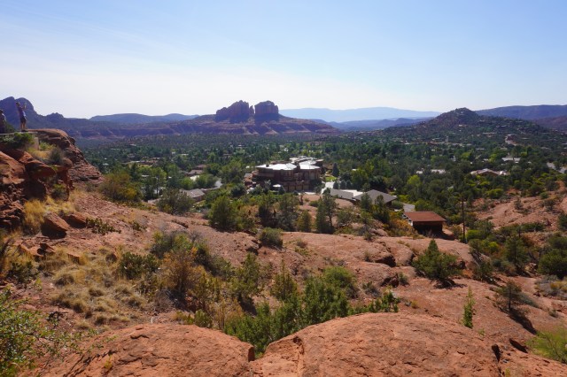
Back on the road, we hit the round-about and went left and west down a broad four lane road bordered by every business one would expect to see in any town that has grown outward from its original center, fast and non-fast food and all kinds of retail. After a mile we went left on Airport Road and made the short, steep climb up the hill to Airport Mesa, home of one of Sedona’s vortex spots and perhaps the most popular scenic viewpoint at sunrise and sunset.
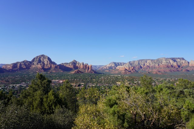
Center Shot from the Airport
As we weren’t there at either of those times and the valley below was shrouded in a foggy haze of smoke from the fires lighting up the western United States, it was still a breathtaking spot, surveying much of Sedona before, stretching for as far as the eye can see. From here, we wound our way back down to Highway 89 and continued west to follow the tour. This took us 2 miles west to Dry Creek Road to head up Boynton Canyon, described one of the most scenic of the box canyons in the area. But from the car, it was hard to know we were in such a canyon, so this diversion was less than stellar.
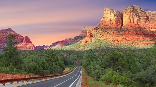
Red Rock Scenic Byway (from the Red Rock Scenic Byway.com)
Back on the 89 a short mile or so took us to the Upper Red Rock Loop Road, which creates a route that passes through Red Rock State Park, one of Sedona’s most popular hiking, picnicking and photography spots. Upon completion on Lower Red Rock Loop, we continued out to the 89 and down to North Page Springs Road as we wanted to check it out as a potential route the next day on our bikes. Doing so proved valuable, as we could see how the ride would work out and returned to Oak Creek Village to do some shopping at a nearby market and prepare for the next day. We’ll catch up on that in the next post.
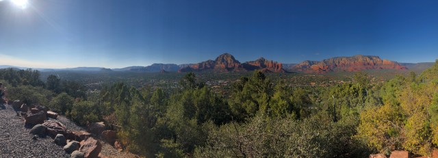
Panorama from the Airport
Links
Sedona Driving Tour: https://www.sedona.net/driving-tour
Chapel of the Holy Cross: https://travel.usnews.com/Sedona_AZ/Things_To_Do/Chapel_of_the_Holy_Cross_62189/
Tlaquepaque Arts & Shopping: https://www.tlaq.com/
Oak Creek Brewing Co: https://oakcreekbrew.com/
Discover more from 3jmann
Subscribe to get the latest posts sent to your email.
